On Thursday of this past week we made a trip up to Custer Park to get together with a host couple there and all of us then drove into Hill City to have lunch at the best restaurant in the Black Hills, the Alpine House. Should you ever visit and spend time in the area this is a place not to be missed with wonderful German food, steaks, and spectacular deserts. We have learned that we get one desert and share it, or eat desert first!
After lunch we made a visit to the museum of the Black Hills Institute. They have an amazing collection of fossils from the dinosaur period. It seems that the Black Hills has been the source of some of the most unique finds anywhere. It is very easy to spend a couple of hours looking around even though the space isn’t large but there is a great deal packed into it.
With the start of the big motorcycle rally in Sturgis nearing, both Custer and Hill City, as well as most other towns in the central to northern black hills are now crawling with motorcycles. While most are pretty good folks, it is very common for the tourists in automobiles to feel uncomfortable with some of the riding done by the more aggressive ones in the groups. The area is mostly made up of scenic but crooked roads and most have pretty restrictive speed limits. It isn’t unusual for the riders to become unhappy with being held up by the drivers of cars and some of them go to lengths to display that displeasure and even harass drivers, particularly if a little slow. If you are not comfortable with them very close to you, riding close behind and passing in bad places, the end of July and early August is not a good time to visit the hills.
Earlier I posted a few pictures from our first visit to the Needles Highway and our experiences there but we now have some new pictures that are truly unique. I believe that I mentioned that tour busses do occasionally squeeze through the tunnels but I now have some pictures of one in the process of this. You need to keep in mind that the tunnel in this picture is only 8 feet, 4 inches wide at the tightest point and about 9 feet at its widest point. This bus did scrape both mirrors at the tightest point and it seems to be what the driver used to tell that he was in the center of the tunnel.
Even though this wasn't one of the largest of luxury busses, it must take nerves of steel to make the transit, and especially so the first time or two. The entry and exit are the easy part as near the center of the trip it squeeses down for a distance of perhaps 30 to 50 feet.
I do believe that if you have any experience driving large vehicles, they are hiring drivers! If you are looking for some seasonal work in the black hills for the summer this just might be what you are looking for.
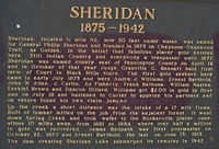
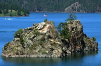
Our first stop was at Sheridan Lake. This medium sized lake now covers the gold rush townsite of Sheridan and is named for it. It is located to the north of Hill City and along US385. The roads are winding and hilly but easily traversed and the lake has public fishing, boating, and a campground as well as a public marina. It is a very pretty lake with many fishermen.


This has been a busy weekend but like most Sundays, the exodus began pretty early. We did have one open site all weekend but strangely someone paid for it from Thursday through Sunday but never did arrive. That does seem too happen at times and once wonders why since SD parks will refund all but the first night for people if they can’t use their site. It is too bad also as we nearly always turn some folks away on nice weekends. This time we also had four visitors using slots in the equestrian campground which was not in use by horsemen.
Today is also expected to be our warmest day of the year with a high of 940. It is now 3 pm and my thermometer reads 920 so we may well get there. With our humidity at only 25% it really isn’t that bad, especially if you can stay in the shade. The boat ramp has been pretty busy and the traffic has changed from mostly fishermen to mostly water skiers. We cleaned out most of the fire-rings this morning as folks were leaving to get a jump on the week’s maintenance work. Otherwise it has been a pretty lazy day with just watching folks leave and using the computer to check them out. We do have two longer term visitors here and three more due in this evening.
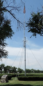
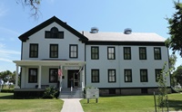
It is the location where chief Crazy Horse was killed, and later was the scene of the “Cheyenne Uprising.” Some years later it was made the largest remount center for the US Army supplying both cavalry horses and draft animals to the artillery and quartermasters. By the start of WWII it was also the home of the training program for “War Dogs” which was the first use of dogs in combat by the Army. During WWII there was also a POW camp constructed there which eventually housed more than 3,000 German POW’s.
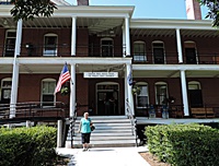
Today the park houses three different museums, has two large campgrounds, an active playhouse, riding stables, stagecoach rides, horse drawn tours, bike rentals, walking tours, campfire programs and many other activities. There are buildings of the former housing areas which are available for visitor rentals as are the officer quarters. The main cavalry barracks now hoses a gift shop, restaurant, and some rooms for rental. Some of the former remount stables are now available for rental of those who travel with horses and there are miles of trails to ride. Another interesting stop is the original Ft. 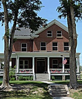
There are tours of the park available or you can drive your private auto through most of the areas as long as ou stay on the roads. The park is home to a heard of buffalo and bighorn sheep have been reintroduced to the bluffs along the ridges of the park, although they are seldom seen by visitors. The coyote, NE state animal is pretty common.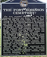
The fort is of special interest to me as my father’s older brother was a soldier who was stationed there for several years in the period of about 1922 to 1925. While visiting the historical society museum I was given the email for a person who was historian there and who has custody now of the fort’s personnel records. Because my uncle was medically discharged and sent home to die, it would be very interesting to see if more can be learned about him as my father actually knew very little.
Ft. Robinson is locates near Crawford, NE and on US20. It is near the border with South Dakota and a short distsnce from the Black Hills.
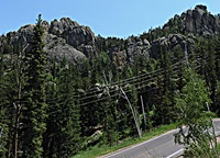
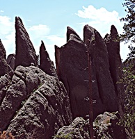
The road is made up of many very tight hairpin turns and has three very narrow tunnels. The first is quite short, only 10 or 20 feet long and is 10 feet 6 inches wide by 10 feet 7 inches tall. What makes it challenging is that it comes at the apex of an outside turn. As you near the top you arrive at Sylvn Lake, where SD89 also comes up from the south and gives an alternate route for those wishing to avoid the tightest of the tunnels. Sylvan Lake is a beautiful spot and has a lodge, campground, and even canoe & boat 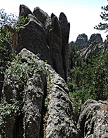
A few miles father to the east there is a scond tunnel that requires a bit more as the width falls to only 8 feet, 4 inches and it is probably at least 50 feet in length but 12 feet high. All of this is interspersed with some beautiful views and facination rock formations. It doesn't take a lot of study to understand the reason for the rocks being called needles as there are many small verticle formations and spires. At the very top is one called 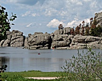
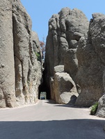
The last tunnel is the most narrow at only 8 feet, 4 inches wide. We did see a dually truck approach from the parking at the west end and after checking mirrors closely, he chose to back into the parking area and return to Sylvan Lake. What really blew our minds was that as we were decending the east side, well below the last tunnel we met a tour bus heading in that direction. Wheter they turned around at an overlook or somehow made it through the tunnel, I will never know but I can say that we were both certain that we would not have traded places with the 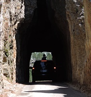
Even though it means leaving the RV behind for most of us, I highly recommend that you take the time to travel this very exciting and spectacular road! There are some things which are just too good to miss, even when difficult.
On July 9 we made the trip to Mt. Rushmore for the evening lighting ceremony. Let me say that if you visit this place you need to stay for the evening program if at all possible.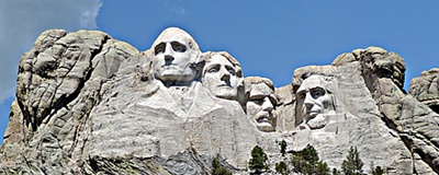

After the trip over this interesting and scenic road we then drove into Keystone where we had dinner. We have now eaten in Keystone on three occasions and find the food to have been best at Teddy's Deli for sandwiches while both places we had dinner were very high priced, didn't have most of what they advertise and the food was at best, MAT (makes a turd) food in quality. About 6 pm we drove on up to the monument for the evening program. We chose to arrive early in order to be sure of seat selection and while that may be a good idea, we were earlier that really needed. But we spent some time looking around again and this is also a place we find easy to just pause for reflection.

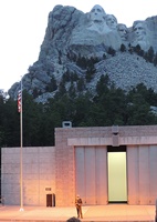

As we were departing from the stage area we all exchanged introductions and a young man came up to assist the Korean war veteran as he was quite infirm. I introduced myself to the fellow of perhaps 30 years or less. He told me that he was not a veteran but had overheard the older man wishing that he were able to go down and participate but doubting that he was physically able and so he just asked to be allowed to help that older veteran get down to participate and then back to his group that he came with. He was not a part of the veteran's party and didn't even know who the veteran was, but just had a sense of what it might mean to the older gentleman. When I began to thank him for his thoughtfulness, he responded by introducing the veteran and then quickly faded away into the crowd, declining any form of gratitude from either the Korean vet or myself. What a truly remarkable young man this fellow must be. He made my day as he demonstrated that there are still young people here who have an appreciation for what our forbearers have done for us! Whoever that fellow is, he is part of the hope for America's future!

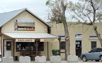
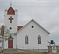
The town is only about a mile from the south entrance/exit of the Badlands NP and doesn't take a lot of time to see buy if you don't visit,
The next place that we visited which is in the small town category would have to be Keystone, just down the road from Mt. Rushmore. This is a tourist town of the first order with fewer than 500 year around residents and a booming population and business district in the summer season. We were told that most of main street is closed up by Thanksgiving and not much happens then until the following May.



Today is Monday and the day after the big celebration and a long weekend as well as the first truly summer weather weekend of the year for this park. Our campground was completely filled in all 20 available sites and 6 of the 11 sites down at the horse camping area were in use. Next to our park is first an RV with many annual rental sites and next to that a mobile home park that is also mostly summer residents. there are also a number of nearby summer cottages and I do believe that every one of those was full as well. Our boat ramp was by far the most heavily used feature of the park with more than 80 vehicles in it as well as others along the road into the park. Over all it was a good weekend with very few problems and none at all from those who were staying in our campground. We did have one incident of a stolen ice chest, full of beer of course. It was never found but since it disappeared on the evening of the fourth, it probably went to the big beer & live music party in the park next-door to us, which was also the home of most of the rowdy folks to be seen. The neighbors did put on a great fireworks show for us and even quieted down before midnight.
All of this simply confirms my long held belief that there are far more good people in the world than there are bad and the camping world is one of the very best of the best. This week is a bit slower than we have had for a time as it seems everyone was here for the holiday and are now home recovering, but we do fill once more next weekend. Tomorrow we are off once more to hit the tourist trail, planning to make a trip over one of the scenic roads that we have not yet covered and then stop at Mt. Rushmore for the evening program before we return here to base. I hope that everyone reading this had a memorable time on this special holiday!![]()


